Heads up: plan ahead , whether you're marching, watching, or trying to get across town. This quick guide shows who’s where, which streets will shut and when, and practical tips for enjoying Toronto Pride Parade 2026 without getting stuck in a crowded transit platform.
Essential Takeaways
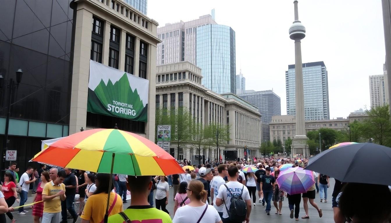
- Parade start and finish: The march kicks off at 2 p.m. on June 28, beginning at Rosedale Valley Road and Park Road and ending at Nathan Phillips Square by 8 p.m. , expect big crowds.
- Main route highlights: South down Yonge Street, right onto Dundas Street West, then to Nathan Phillips Square via Bay Street; Church-Wellesley remains the festival hub.
- Closures to know: Major roads including Yonge, Church, Dundas West, Bay and portions of Bloor will be closed at various times from June 25–28; some closures begin as early as Thursday.
- Transit advice: Take the subway where possible; surface TTC routes will be diverted and platforms will be busy , arrive early and allow extra travel time.
- Accessibility and amenities: Accessible viewing areas, Wheel-Trans pickup points and free water stations are provided across the festival footprint.
Where the parade goes , the route you’ll want to memorise
The procession begins at Rosedale Valley Road and Park Road, moves south on Yonge Street, turns right onto Dundas Street West and funnels toward Nathan Phillips Square via Bay Street. Visually, picture Yonge , the city’s spine , filled with colour and music from mid-afternoon into evening. Organisers and city maps show Church-Wellesley as the street-fair epicentre, so expect thick crowds around Church Street as well. If you want a quieter spot, aim for the northern viewing areas listed on the festival map or arrive very early.
Which streets shut and when , plan your drive or drop-off
Closures start Thursday to set up the street fair and run through Sunday morning in pockets. Key Sunday closures include Rosedale Valley Road, large stretches of Church and Yonge, portions of Bloor, Dundas West and Bay Street, mostly between late morning and 8 p.m. On Friday and Saturday there are targeted closures for rallies and marches. If you must drive, map an alternative route now and allow an extra 30–60 minutes; if you’re picking someone up, use a peripheral meeting point rather than trying to get into the festival zone.
Getting there by TTC , the subway is your best bet
Several surface routes will be diverted around the downtown parade corridor, so the simplest way in is subway: Bloor–Yonge, Wellesley, College, Dundas and Queen stations will be the main access points. Trains and platforms become extremely busy before the parade begins, so aim to arrive well ahead of the 2 p.m. start or plan a staggered arrival. If you need door-to-door accessible service, Wheel-Trans pickup points are marked on the festival map.
Best viewing spots and quieter alternatives
Designated viewing areas run along Yonge Street at Charles, Elm, Edward and other cross streets, with additional Sunday-only viewing at Isabella, Maitland and Wood streets and Nathan Phillips Square. These zones are useful if you want a clearer line of sight without squeezing into the densest crowds. Festival stages and DJ risers on Church Street and Nathan Phillips Square fill the schedule, so check times if you want to catch specific performers or speeches.
Safety, hydration and accessibility , small things that matter
Summer heat plus crowded streets means hydration is essential. Free water stations will be at Nathan Phillips Square and near the DJ risers at Church and Isabella, and organisers recommend bringing a refillable bottle. The festival map shows accessibility hubs, alternate routes and accessible viewing areas , do use those resources if you need them. For families or those who prefer calmer zones, scout the map for peripheral areas away from main intersections.
It's a weekend to celebrate and support the LGBTQIA2S+ community , just bring patience, a refillable bottle and a plan.
Source Reference Map
Story idea inspired by: [1]
Sources by paragraph: